Thursday, September 1, 2011

[Trek] Mount Rinjani, Lombok, Indonesia

27th -31st August 2011 (5 Days)

The famed Mount Rinjani at 3,726m in Indonesia was my first trekking experience after something like 3 years. We actually spent something like 2-3 months training at Bukit Timah Hill climbing the stairs over and over again. Those were the times I lost a lot of fats, I say fats because for some weird reason, my weight has only made a  ± 2 kg in the last 14 yrs. I just shrink and expand. 


Getting there, Silkair from Singapore departs only on Wednesdays and Saturdays. Tickets were at $400++ There are of course cheaper ways such as flying in to Bali and then a domestic flight. We decided on a less time consuming way. Working adults need to scrim on our leave.

We checked it slightly after dinner time to rest before a really early start and a 3hour drive to the base of Mt. Rinjani.


The group sorting out the luggage on how we want to bring up our stuff, what to pass to the porters etc.


This would be our accommodation on the first and last night. Only myself and one other guy decided not to head over to Gili Islands for a few days of diving. I had limited days of leave left and I didn't want to spend too much on this trip because I had already spent a LOT on gear and the right outer wear.

Everyone looking really fresh not knowing what lay ahead...

At the park office to register. So that's where we're heading! (I think) 
Starting out. Cool weather, lots of cows, lots of cow dung too. You can see our porters already far far ahead. 

At the first rest point. If you're really not keen on spending over $100 for a trekking pole, which trust me, you will need, Mustafa sells $10 trekking poles/walking sticks that will be good for a couple of times before they fail. These two lasted me through the trip before they decided to not 'lock' any more.  I borrowed my friend's Osprey bag, but it didn't really fit me very well. Nonetheless, I did survive. For long treks, you want to be as comfortable as possible. 


Stopping for lunch. As you can see, lots and lots of hikers. By the time we reached this bridge, about a 2 hour plus hike, we were already above the clouds!


A bunch of happy campers, after nearly 8 hours, we reached our campsite! 
Lots of others camping along the ridge. At that time, 4pm, it was already getting cold. Once we changed out of our clothes, it was thermals, fleece, outershell, gloves and wool socks. 


According to our guide, we were supposed to be up by 2am to move off at 3am. But we were delayed slightly. Balaclava and two jackets for me. This was probably below 10 degrees C, it's gonna get worse.


 At sunrise. I didn't reach the summit sadly because I was having a lot of stomach problems. But maybe that's just an excuse. The trek up is gravel, like they say, 3 steps front, 2 steps back. You can't just take a step forward, you need to literally move as fast as you can a few steps and hope to not fall back too far. Plus the air is thin as you get higher and higher.

 Over looking the crater. Magnficent!!

By the time we reached the summit, not the peak, it was already zero. Lots of strong winds too. 

Everyone wrapped up like bazhang.

The descent was just as bad. Because of all the loose volcanic rock, going down can be quite a challenge. It's one of those, you can't be afraid and just slide down things. But the sides are narrow and you really don't wanna fall off the sides. We had a few close calls. 

After everyone reached back to the camp site at around lunch time, some of us took a nap because it was really one of the most tiring things I've done in my life. Full marathon, oh please. This is far worse. During the descent, every time I sat down, I literally fell asleep. That was how tired my body had become and I didn't even know it. 

The descent to our second camp site by the crater lake was a little more enjoyable. Keep in mind, this is already after 9 hours of ascent and descent. Lunch then a further descent. A rocky path and from what our guide told us, a couple of weeks before, someone fell off and died. So I must say when we were told that, it was a little daunting. He made it sound like one wrong step on either direction you'll be dead. It wasn't that bad actually, although we had to do some simple rock climbing up somewhere along the way.

 Our guide looking ahead to where we're gonna be spending the night.

After about another 4plus hours of hiking down, our lovely prime property with scenic view. And if you really really feel like you need a bath, there's the hotspring about a 20minute walk away from the camp. It's cold here too. But the dip in the hotspring was really worth it. At least cleaned off some dirt and grime. 
This is the point where people decide if they want to do a 3D2N or a 4D3N thing. If we wanted to cut short our original plan, we had to wake up at 2am (again) and set off. A group camping at the same place set off around that time. We decided to take a more relaxed time and leave after breakfast.

The ascent on this portion isn't too bad. I would say moderately difficult. I love how the types of vegetation changes as you get higher or lower during the trek.

 By lunch, we reached the second crater rim. The first crater rim being where we camped the night before.

The summit of Rinjani is somewhere on the left side of the photo above. The volcano is the one in the centre. 


Second crater rim and lunch area. We decided to cover more ground instead of camping here for the night. 

As you can see it looks rather hot and dry. Because it was on this side of the mountain. On our final night of stay, there was a forest fire that was less than 100m away from us. In the night we actually packed our things and ready to run if there was a need to. Luckily it never came to that.

This time the descent was more of a sandy one. 

Slowly the trek turned into a more tropical one, and you can be sure, it means we're nearing back to the base.

And finally. We ended at the Senaru end...

This is also where we made our separate ways. The diving group to Gili Islands and I was heading back to Lombok for a day in the town. We did take one of the passenger boats the next day out to Gili Islands before our flight back to Singapore since we had time. Maybe I'll be back to Rinjani again or maybe just to dive.

 On the way back to the resort at Lombok.
 After 4 days of trekking, coconut juice never tasted so good.
And for a change, looking sun-kissed and getting into the beach resort feel.


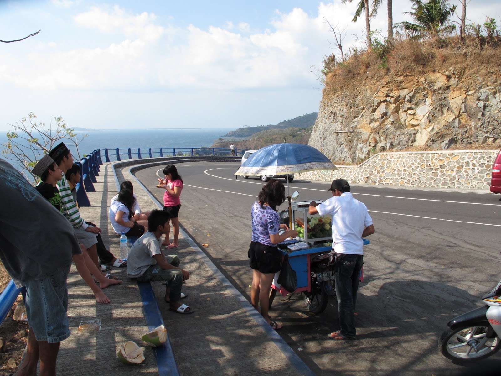
Around Lombok. It was Hari Raya Puasa earlier in the week so the whole town seemed rather deserted. We were encouraged to pay the porters a bit more since they had been fasting during that period. 

 Horse carriage ride around.

Sunset at the beach

Trying some local satay and kutupa. 


Our flight back to Singapore was only in the evening on Wednesday, so we decided to head over to Gili Air (pronounced as ai-yer) where the rest of the group was.

 Passenger boats for the locals.

 The amount of things on it was crazy!

 By some miracle, we managed to find them all. Happened they were out having a drink when we walked by.

Gili Trawagan is the more popular and the biggest of the Gili Islands. 

Best time to go: Probably around July to September, diving would be good as well.
Budget: For the trek alone for a 4D3N plus 1D at Lombok, I spent about $1000 inclusive of flight. If you include the 3 days of diving, that's another $400. 

Friday, May 13, 2011

[Climb] Yangshuo, Guilin, China

2nd - 9th April 2011(8 Days)

Climbing is just an excused to get out of the country for me to explore places that sometimes, isn't really a tourist haven. So far, in my limited experience with China, I have actually liked it quite a lot. Even though my Mandarin is barely there.

Yangshuo is a town in Guilin in the province of Guangxi. In short, southern China. It was put on the map as a rockclimbing destination only after early 1990s. We had a few friends who went up before and had raving awesome reviews. So we too decided to see if it was worth raving about.

File:YangshuoFromTvTower.jpg
Photo from wikipedia.

This is starting to be a usual trend where I seem to be going to places out of their peak season. We travelled early April. The best time when the weather's good is from about late April to early October. There was a group up there a few days before and they told us the weather was awesome, cooling and sunny, averaging about 24 °C. But when we got there, it was rainy and windy, most of the time, the temperature was below 13°C.

Since I sold off my DSLR and friends, I now use my Domke bag as a miscellaneous compartmental bag for travel. Things to survive, wallet (duh), a good book (The Girl With the Dragon Tattoo), spectacle and contact lens case, my oakley sunglasses a 21st bday present, ATC (I forgot why it's in my carry on and not check-in), klipsch earphones (I swear they're the best), and other personal items.


Tiger Airways used to fly to Guilin, but last I heard, they stopped the flight. Tickets were only >$300 during the promotion. About a 4 hour flight, we landed in Guilin all set to take a van ride to Yangshuo. Not too long, about a couple of hours. The roads were clear like nothing I've ever seen before.

We stayed at Riverside Lodge, recommended for climbers. The owners themselves climb and were extremely helpful in arranging transport to the crags. 


 We paid roughly S$10 a night per person. Not bad I say, not bad. Hot water, heaters, air-con (although we really didn't need that at all) and TV. 
  Albeit not so awesome view of people's laundry. 

Yangshuo is surrounded by beautiful limestone krasts, and it's not too touristy yet. 


River that runs through the town.

 Second day onwards, we headed out to the rocks
Egg Mountain. I still fail to see the resemblance. 

The guys trying to see the routes. 

I brought my camera up, yes, that is someone's farm in the background. It was really that cold I had to wear my chiong fleece jacket we bought at the town the night before. 

Most of the trip was spent going through people's farms to get to the crags. We tried our best to stay discreet. 

On our "rest" days from climbing, also because the weather was really getting quite unbearable to climb, we decided to do some touristy things like see the limestone caves and watch a waterthemed concert.


 Some neon lights for the limestone. It's quite a bit cave and somewhere along the route, I got lost and only caught up with the group much later. 

 Honeycombs. What they do is they hack off about a kilo for you. The thing was, later on when we wanted to eat it, we realised utility knives weren't as powerful as the hammers.

It was cold I tell you. Worse is that we didn't really have the clothes for the weather.

 Some really amazing walls. 


Walking to the crags again. We spent a lot of time walking and finding the crags. 

Twin Gates. 
 After a very tiring walk up Moon Hill. The Moon in Moon Hill.

The weather was just making my photos look bad. But one of the scenic highlights of Yangshuo.

Belaying 


 We saw a whole lotta cute dogs on the way too! 
So there's this bouldering gym that many of the climbers hang out on their 'off days' too.


I thoroughly enjoyed myself in Yangshuo. We didn't get to try many other tourist activities like rowing down Li Jiang (Li River) because much of the time was spent climbing. Although I'm not as proficient as the rest, I still had a great time there. There's the other option to make a stop over at ZhangJiaJie which is also known as the Avatar Mountains. I'm definitely heading back. 

Best time to go: Late April - June, September - October. 
Budget: 8 Days - Total of $800. Accommodation is very affordable, food as well. Inclusive of buying some clothes for the rainy windy weather.